West Elk Loop And Scenic Byway
205 Miles Circling Stunning Scenery
Mountain peaks, alpine wildflowers, ranches, and the Black Canyon of Gunnison.
Local’s Tip
While this route has stunning scenery any time of the year, the fall foliage is a show-stopper.
A Wilderness Experience from a Car
The West Elk Loop and Scenic Byway was once described by a forest ranger as, “the closest you can come to a wilderness experience in a passenger car”. The route travels past wilderness areas, national forest and state parks. It follows old railroad tracks and explorer paths from days gone by.

The Stats:
Distance: 205 miles loop
Time: 6-8 hours drive, plan more time for stops along the way.
Along the Route:
Wildlife: Elk, mule deer, bighorn sheep, and mountain goats
Plants: Aspens, Blue Spruce, Cottonwoods, Ponderosa Pine, wildflowers
Wilderness Areas: Maroon Bells-Snowmass, Raggeds, West Elk, Fossil Ridge
National Forests: White River National Forest and Gunnison National Forest
National Parks: Black Canyon of the Gunnison National Park
Redstone is the perfect basecamp of activities along the West Elk Scenic Byway. The loop starts in Carbondale, heads south on Highway 133 through Redstone over McClure Pass to Somerset, Paonia, Hotchkiss, then follows Highway 92 towards Crawford. The loop then turns on to Hwy 50 towards Black Canyon of Gunnison National Park and Gunnison. Finally, it loops around on Highway 135 to Crested Butte. In the summer, you can take the maintained gravel Kebler Pass Road back to Highway 133. In the winter, you’ll need to retract your path.
The Sights:
Carbondale: The route starts in Carbondale, a fun, outdoor town that’s also a designated Colorado Creative District. Fuel up here if you are low on gas. The next gas station is 60 miles away.
As you leave Carbondale to the south, Highway 133 follows Crystal River and Mt. Sopris will dominate your view.
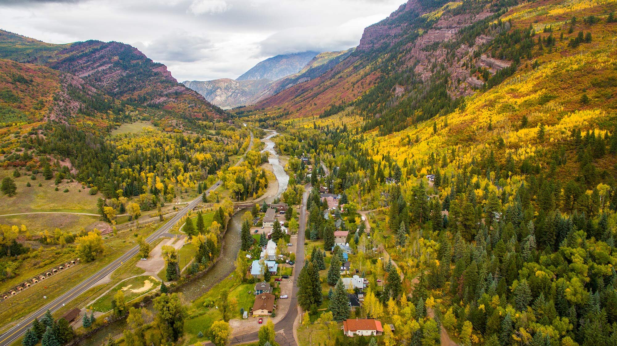
Redstone: Redstone is a cozy mountain town that’s steeped in history, art, and community. The entire town is listed on the National Historical Registrar. Stop off at the Redstone Coke Ovens for a history lesson then take a stroll over to Redstone Boulevard for some shopping and a scoop or two of ice cream.
Continue south to the cut-off for the Town of Marble.
Marble: Marble is an eclectic and remote town that is located at the end of Gunnison County Road 3. Marble is also a mining community, named after the pure white marble found near Yule Creek. This marble deposit is still actively mined today. Stop by Slow Groovin BBQ if you are hungry and see the beautiful sculptures created from Yule Marble in the art galleries or Marble Town Park.
Twist and turn your way up to the top of McClure Pass. You’ll pass the mining communities of Somerset and Bowie on the way back down. Consider a stop to cool off or simply enjoy the view of the Raggeds at the Paonia Reservoir located in the Paonia State Park.
Paonia and Hotchkiss: These agricultural communities are a dramatic contrast to the rocky cliffs of Redstone and Marble. This area is known as the “farm-to-table capital of Colorado”. It boasts around 10 wineries and lots of fresh fruits and vegetables. Wineries are normally open for tastings and tours from May to October. There are some pick-your-own farms as well as already harvested selections. Paonia is also part of the Colorado Creative District.
Turn Left onto Highway 92 toward the town of Crawford.
Crawford: This farming and ranching community has a few restaurants, shops, and gas. It’s the gateway to adventure. There is great camping and exploration inside Crawford State Park and Black Canyon of the Gunnison National Park.
Twist and turn your way down Highway 92 towards Blue Mesa Reservoir. Cross the Blue Mesa Dam, and turn left onto Highway 50. You’ll be greeted by the Blue Mesa Reservoir. With 96 miles of shoreline, the Blue Mesa Reservoir, the largest body of water in Colorado which is part of the Curecanti National Recreation Area.
From here, the road heads north on Highway 135 towards the town of Gunnison and Crested Butte.
Gunnison: A historic ranching town with lots to explore and is home to Western State College. There is also great mountain biking, a vibrant art scene, and lots of restaurants.
Crested Butte: Take a walk or drive down the streets filled with elegant Victorian buildings. If you are there in late summer, take a hike to see some wildflowers. It’s known as the “Wildflower Capital of the World” for good reason.
From Crested Butte, you can take Kebler Pass, a maintained gravel road back to Highway 133 and head north back to McClure Pass and Redstone. Alternatively, you can retrace your route if Kebler Pass is closed for the winter. Kebler Pass has gorgeous views of snowy mountain peaks and forests plus lots of hiking trails to explore.


